Recommended Routes & Itineraries
Discover the sacred peaks of Omishima
Trade bikes for hiking boots to discover mysterious rock formations and stunning views of the Inland Sea from the sacred peaks of Omishima Island.
Oyamazumi Shrine may be dedicated to Shinto deities associated with the sea, sailors, soldiers, and battles, the enshrined deity Oyamazumi, the elder brother of the Sun Goddess, is described in the 8th-century Kojiki (“Record of Ancient Matters”) as “the god of the mountains.”
The shrine itself sits at the foot of three sacred mountains, the tallest of which is Mt. Washigatozan, the highest peak on the island, at 436.5m.
This hike takes you through the precincts of Oyamazumi Shrine, past its ancient camphor trees, and up to the peak of Mt. Washitagozan, via Mt. Anjinsan, another of the three sacred peaks, and along a spectacular trail along a ridge with many impressive rock formations.
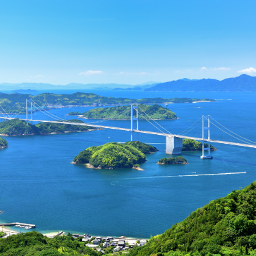
With uncomplicated trailhead access and a well-maintained, though at times steep, path, this out-and-back hike offers incredible views of the surrounding islands, delivering an entirely new perspective of the Shimanami Kaido.
Distance: Approx. 6km (ou and back)
Vertical gain: Approx. 550m
Estimated Time: 3-4 hours (including breaks)
Caution
The trail is well-maintained, with much of it on asphalt thoughtfully incorporated into the natural surroundings. However, it is very steep in places and can be slippery when wet.
Although the distance is relatively short, please allow plenty of time for the journey and be sure to carry extra clothing in case of sudden weather changes.
There are no water sources beyond the trailhead, so please carry fluids and snacks.
※ All distances approximate
Mt. Anjinsan and Mt. Washitagozan Hike
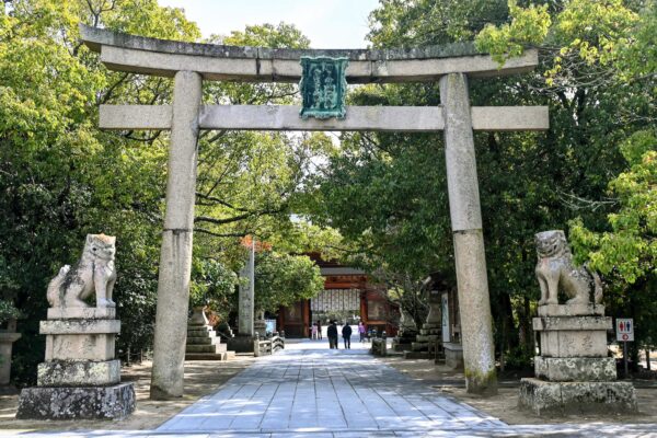
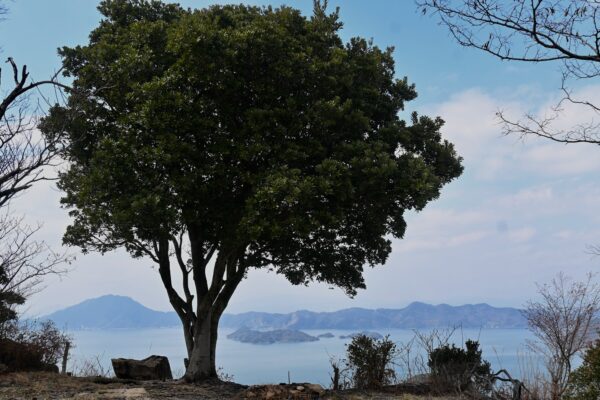
Oyamazumi Shrine
Enter the precinct of Oyamazumi Shrine by passing under the grand stone shrine gate and through the main gate, which is flanked by two guardian warriors carved in wood.
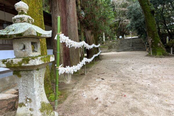
Beyond the impressive 2,600-year-old camphor tree at the end of the main approach, a set of steps leads up to the courtyard, where the shrine’s main worship hall is located.Why not pay your respects at the main hall and make a small offering before embarking on our hike?

Approx. 300m
Tsuruhime Road
Return to the top of the steps between the main courtyard and the camphor tree, and, with the main hall behind you, head left, keeping the line of stone lanterns on your left-hand side, until you reach another short set of stone steps up to a short arched bridge, before three tall Buddhist stupas made of stone.
Turn left after crossing the bridge, and along what is known as Tsuruhime Road, in an uphill direction.
Approx. 120m
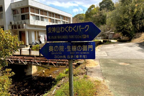
Sign to Mt. Anjin Wakuwaku Park
Walk up the path for approximately 120m, where you will come to a crossroads with a blue sign on the left. The road to the left takes you to Iki no Gomon, a much-revered ancient camphor tree, which you can literally walk through! It’s about 220m to the tree, and well worth visiting if you have time.
The road to the right climbs up to Wakuwaku Park, where the trailhead is located.
Approx. 80m
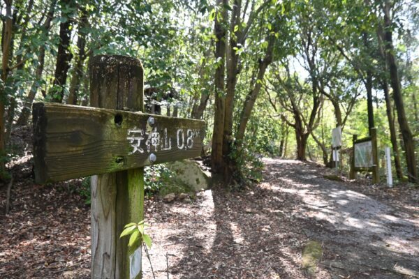
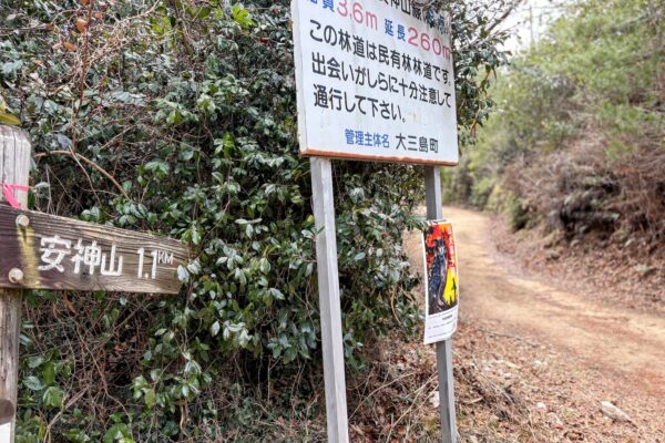
Mt. Anjinsan Trailhead
A short walk beyond the public toilet is the trailhead. Here you will see a sign in Japanese, indicating it is an 800m walk to the summit of Mt. Anjinsan. By the signboard on the right, you might find some walking sticks left by some kind souls.
Approx. 80m
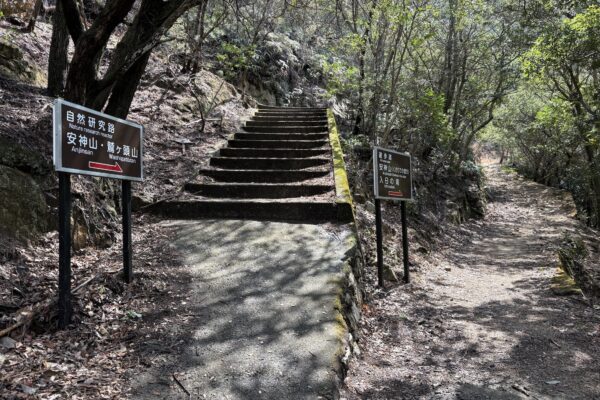
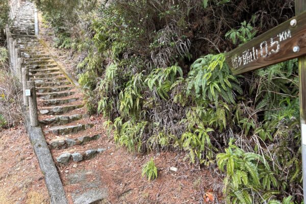
Mt. Anjin Hiking Trail Fork
When you come to this fork in the trail, be sure to go left, up the steps. The fork to the right takes you to a far more technical route that involves some climbs up chains that would bring tears to a mountain monk.
Approx. 100m
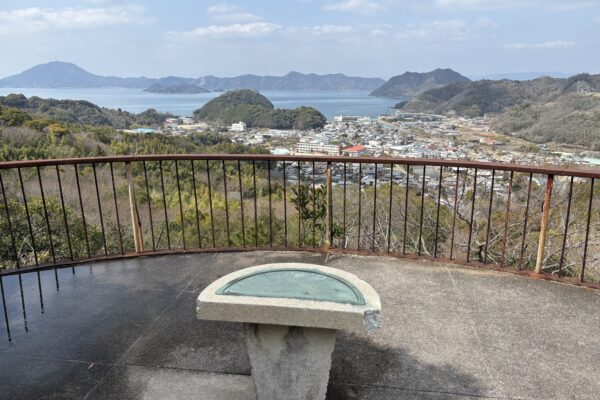
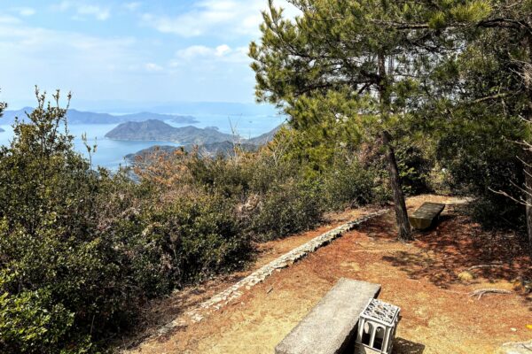
Mt. Anjin Observation Platform
From the top of the steps, the path zigzags steeply up to the Mt. Anjin Observation Platform. Even if you decide to call it a day here, the platform provides a great view of the town around Oyamazumi Shrine and out over the bay.
Approx. 600m
Mt. Anjinsan Summit (266.8m)
The climb to the top of Mt. Anjinsan now begins in earnest. The path is mostly asphalt, with raised rocks embedded to improve grip and occasional sets of steps.
Along the way, look for a short trail that doubles back on the left of the main trail, offering a treat of a view over a rocky outcrop with a small shrine and the surrounding mountains.
Return to the main path and continue onwards and upwards!
The summit of Mt. Anjinsan is a wonderful spot. Large boulders encircle a small clearing, which offers 360º views over the Inland Sea and over the ridge that leads you towards Mt. Washigatozan. On a nice day, it’s a perfect spot to take a break. If so moved, you can leave a small offering at the tiny shrine here.
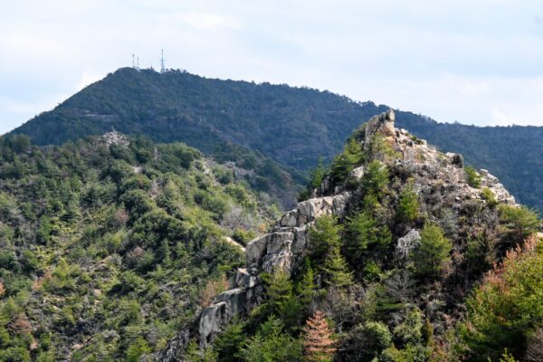
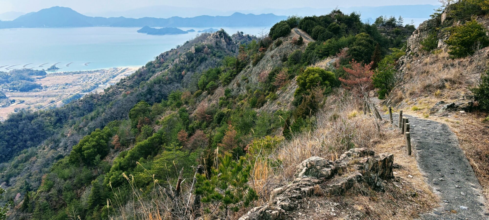
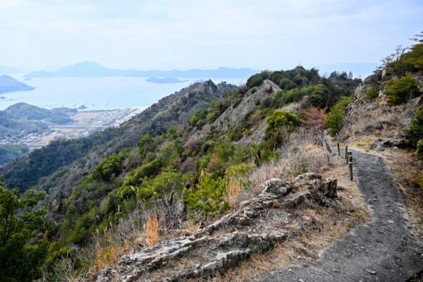
Mt. Anjinsan Ridge
From the summit of Mt. Anjinsan, you can clearly see the rocky ridge that leads to the trail that climbs to the top of Mt. Washigatozan (recognizable in the photo by the transmission towers).
Although it may appear daunting, the trail is very walkable and much less strenuous than the path that brought you to the Mt. Anjinsan summit!
Approx. 10m
Ojigi Iwa (Bowing Rock)
As soon as you continue on the trail, you are forced to duck (or bow!) under a low rock that protrudes from the side of the mountain and over the path.
Approx. 200m
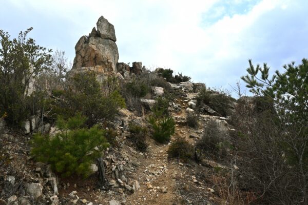
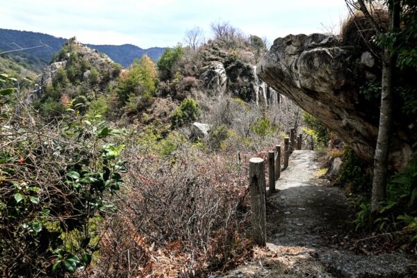
Eboshi Iwa (Eboshi Rock) 278m
The path becomes more “trail-like,” with the asphalt path giving way to gravel. Shaped like the distinctive tall hats worn by Shinto priests (called eboshi in Japanese), this rock formation is believed to have inspired great awe in ancient times. Actually, about 10m higher than the Mt. Anjinsan summit, it is really very striking. However, if you leave the main trail to take a closer look, do be careful of your footing.
Approx. 650m
End of Mt. Anjinsan Ridge Trail
Over a mix of asphalt and gravel, the undulating trail takes you over two more significant rocky outcrops, with splendid views all along the way, as it gradually gains elevation, until you reach the end of the trail. From here, follow the dirt road to the tarmac road that cars use to reach the top of Mt. Washgatozan.
Approx. 260m
Entrance to Mt. Washigtozan Trail
Look for the start of some steep steps on the other side of the road, and prepare yourself for a lung-busting 500m climb, with a brief respite halfway at a small clearing where you cross the tarmac road once more for the final push.
Approx. 500m
Mt. Washigtozan Summit (436.5m)
Once you emerge from the trail, make your way past the transmission towers up to the summit, marked by a pile of rocks and a simple wooden plaque. The views from hear or not as good as from the Mt. Anjinsan ridge, but you feel a great sense of accomplishment, nonetheless.
Approx. 2820m
Return to Oyamazumi Shrine
Returning the same way on a hike can sometimes be rather unsatisfying, but in this case, the descent offers a different perspective on all the amazing views. However, please take your time and watch your footing on the steep descents.