Recommended Routes & Itineraries
A cyclist's dream ride through villages, past ancient shrines, and an endless stream of citrus orchards.
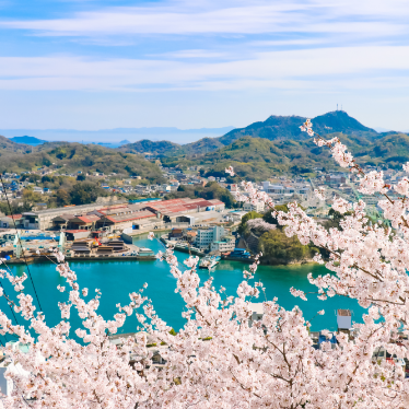
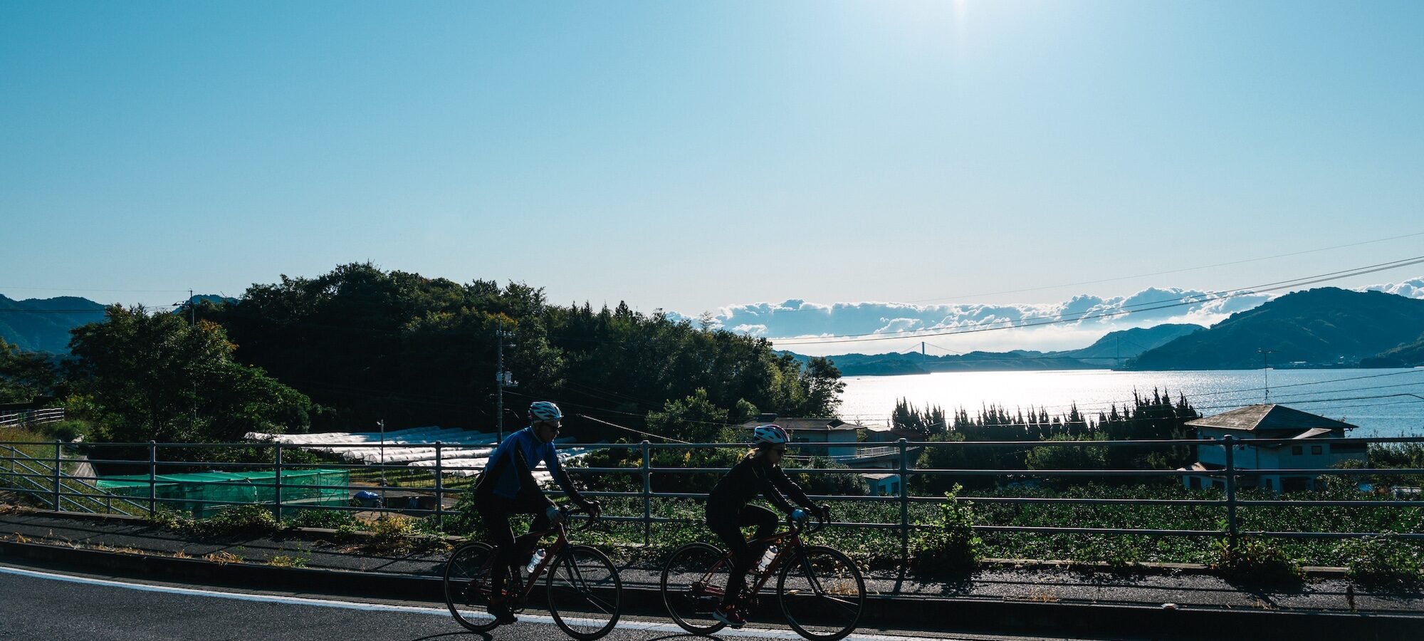
Despite being the largest island on the Shimanami Kaido, Omishima Island gets surprisingly short shrift from the island-hopping cycle route’s popular Blue Line course between Onomichi and Imabari. Home to one of Japan’s most significant shrines, where you find gnarled trees that are over 2000 years old, and with stunning views, Omishima, however, offers some of the best cycling in the region.
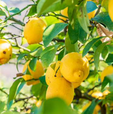
The approximately 40km island loop course that hugs the coast offers an undulating route that, although challenging at times, takes you through small villages, past ancient shrines and contemporary architecture, and an endless stream of citrus orchards. The Omishima Loop is a great option for visitors with an extra day on the Shimanami Kaido, or as a standalone ride for people who like to get away from it all.
This course description begins and ends at Tatara Shimanami Park, and circumnavigates the island in a clockwise direction, which puts you closest to the sea views. It is, however, a great route, wherever you decide to start and finish, and in whichever direction you choose to ride.
Caution
More and more cute cafes and eateries are popping up around Omishima, but opening hours are often limited to only a few days a week. Carrying snacks and fluids to prevent bonking in the hills is recommended.
※ All distances are approximate
Omishima Island Loop
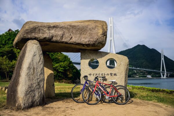
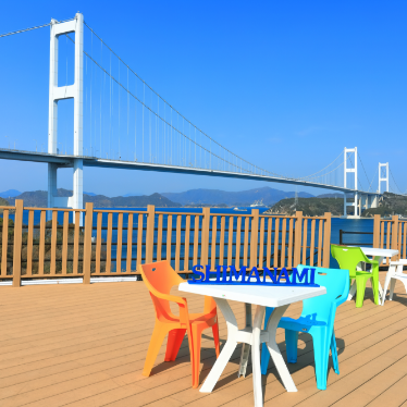
Tatara Shimanami Park
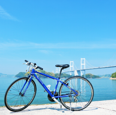
Tatara Shimanami Park is a great place to start and finish. It is the largest Michi no Eki rest stop on the Shimanami Kaido cycling route, with eateries, a souvenir shop, and a farmer’s market. The park is right next to the Omishima Interchange on the Shimanami Kaido expressway interchange, and the bus stop for services to and from Fukuyama, Imabari, and Matsuyama – convenient if you wish to pick up a rental bike from the rental terminal in the park, which is one of the largest on the route.
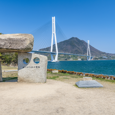
Don’t forget to join the locals and snap a photo at the Cyclist Sanctuary Monument with the impressive Tatara Bridge in the background.
Turn left after departing Tatara Shimanami and follow the main Blue Line route south in the direction of Omishima Bridge.

Approx. 3.2 km
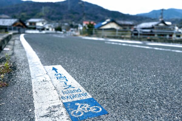
Omishima Island Explorer Intersection
At this intersection, we leave the main Blue Line route to Imabari by taking a right onto Route 5, joining the Omishima Island Explorer route, marked on the road.
The cycle information pillar at the intersection indicates that it is 13.6km to Mukakata Port in the direction in which we are heading.
Approx. 7.7km
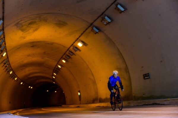
Nonoe Tunnel
After passing a little harbor, we arrive at one of Shimanami’s few major tunnels. The Nonoe Tunnel is 814 meters long, and although it is reasonably well lit, riding on the right-hand sidewalk is recommended.
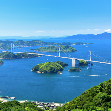
At the other end of the tunnel, a steep climb awaits. Enjoy views across the sea out to the 4-km-long Kurushima Straits Bridge in the far distance as you pump the pedals and then enjoy a thrilling descent around sweeping bends which deliver you to one of Shimanami’s most iconic locations.
Approx. 3km
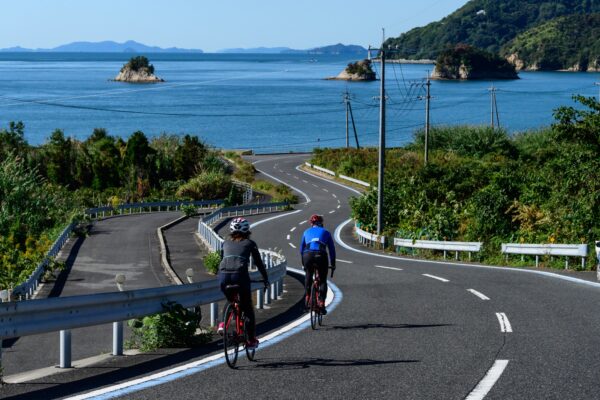
Yahoo! Hill
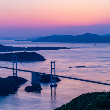
Yahoo! Hill, named by local cyclists for how the thrill of descending this lovely series of S-curves down towards the coast makes you want to scream, “Yahoo!” This is one of the best views in all of Shimanami, and another good reason to ride the coast clockwise.
Approx. 600m
Omishima Ikoi no Ie / Ken Iwata Mother and Child Museum
A short distance from the foot of Yahoo! Hill is Omishima Ikoi no Ie, a former school lovingly renovated into a hotel. Restrooms are available to cyclists, whether they are staying overnight or not, and if the weather is not in your favor, you can shelter from the rain here, too. In good weather, the small beach just over the seawall is a great place to take a break before the next hilly section.
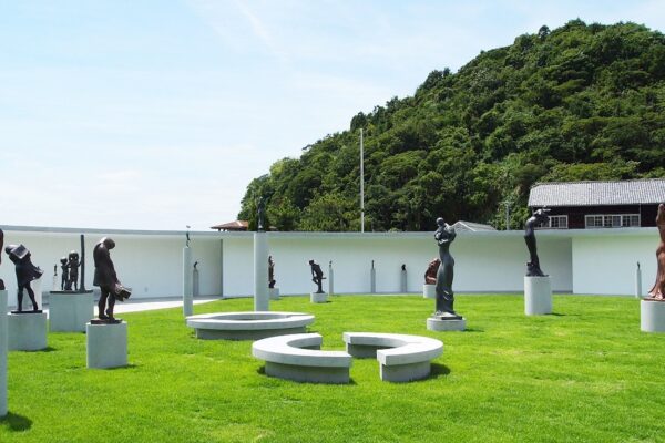
The atmospheric sculptures of the Ken Iwata Mother and Child Museum are also here, one of three distinctive art museums along the southwest coast of Omishima.
Approx. 2.5km
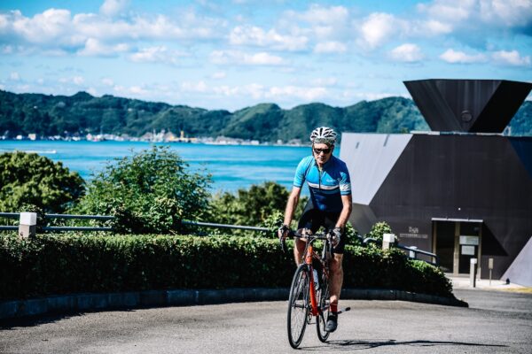
Toyo Ito Museum of Architecture and Tokoro Museum
Continuing onwards, after passing Munakata Port, a short distance from the (from where there are infrequent ferries to and from Imabari, the road, once again, heads upward. Follow the sign for Miyaura Port and dig into the 1.4 km climb up to two spectacularly located museums.
The Toyo Ito Museum of Architecture and the Tokoro Museum are about 200m apart. The former is dedicated to the work of architect Toyo Ito, a main driver behind the renovation of Omishima Ikoi no Ie, and has strong links to the island. The latter is a quirky contemporary art museum with a stunning terrace.
Moving on, enjoy a well-earned long descent, until, inevitably, the road rises and descends sharply again. Another steady climb delivers you to a wonderful descent with the rocky summit of Mt. Anjinsan framed between the two painted blue lines on either side of the road. We are now approaching the mid-point of the ride, and you can look forward to an uninterrupted stretch of mostly flat road for the next few kilometers.
Approx. 6.5km

Utena Beach and Hakata Salt Factory
Consider making a 700m detour from the Island Explorer’s blue line to check out one of the prettiest beaches on the island.
Utena looks particularly nice when the tide is out, and white sand flats are revealed, and a variety of birdlife come to snack. You can also pop into the Hakata Salt Factory and have a look around for free.
The most direct route follows the edge of a small river, and the track turns to gravel for a short distance as it passes by a large reconstruction of salt making apparatus made of reeds set up in the back of the salt factory.
Follow the seawall along the beach across from the channel in front of the salt factory, and the road will take you back to the main Island Explorer line in no time.
Approx. 1.5km
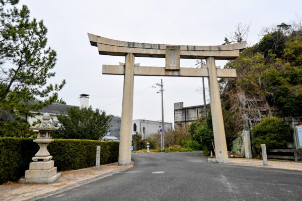
Oyamazumi Shrine First Shrine Gate/Miyaura Port
When you reach the great shrine gate that stands at the entrance to the approach to Oyamazumi Shrine, it’s time to make a decision.
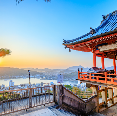
You can continue on your way around the island. Or, you can make a short detour to visit Oyamazumi Shrine. It is the gem in Omishima’s crown, and one of the oldest and most significant shrines in Japan, so, unless you have already visited or plan to return after you finish your ride, we urge you to take a look.
Make your way to the shrine from this shrine gate, facing the sea, to follow in the footsteps of some of Japan’s most illustrious samurai warriors who came here to pray and give thanks for victory in battle.
Approx. 300m
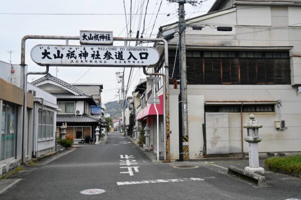
Oyamazumi Shrine Sando (Approach)
The approach to Oyamazumi Shrine is a shadow of its former self, but many of the now-empty buildings give you an idea of the days in which people from all over Japan would make a pilgrimage and have fun afterwards.
&nsbp;
You can find local spots, such as Yoshikawa and Tairyo, serving excellent seafood, as well as cafes such as Sando, Omishima Brewery, and Omishima Winery Minna no Ie, run by a younger crowd who have relocated here to make a life and revive the area.
Approx. 650m
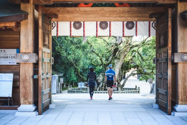
Oyamazumi Shrine
Oyamazumi Shrine is an ancient shrine with impressive camphor trees on its grounds, estimated to be well over 2,000 years old.
If you have time, check out the amazing collection of samurai armor and weaponry housed in the shrine’s Treasure Hall.
Approx. 850m
Oyamazumi Shrine First Shrine Gate
Approx. 10km
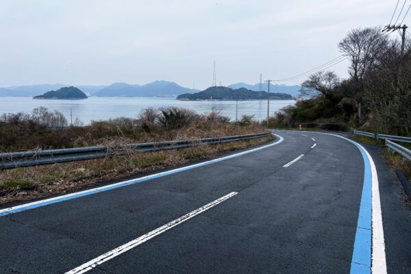
Sakari Port
Rested and refuelled, we continue around the northern part of Omishima Island.
You may notice that there is even less traffic as you cycle along the seawalls and past ever more citrus orchards. If you are visiting between Friday and Tuesday, listen out for the sound of jazz music and the aroma of home cooking, wafting from seafront Umimachi Bal Ameri.
The road takes a hard left at Higai (Google Map), signaling the start of another hard climb.
If you’d like to break up the 1-km climb, pop into Higai Hachimangu Shrine, located on the right above a small citrus orchard. The precinct contains some impressive antique stone masonry, and the incredible carpentry is on display at the main shrine building, which stands atop a Ghibliesque flight of steep stone steps.
After conquering the rest of the climb, the road descends to the northern tip of Omishima, providing a great view of Okunoshima, more commonly known as “Rabbit Island,” instantly recognizable by the towering pylons that once carried power across the water.
Ferries to Rabbit Island take just 15 minutes and depart about once an hour, during daylight hours.
Approx. 5.5km
Tatara Shimanami Park
From Sakari Port, it is a flat 5 km back to Tatara Shimanami Park to conclude our ride. Look out for unstaffed “honor shops” where you can buy local produce, fresh from the farm, by dropping a few coins into a pot in the knowledge that it goes directly to the farmers themselves.
If you cannot wait (or resist) until you reach the finish, there are quite a few places offering tasty morels and refreshing drinks that have opened along the final run-in. Having conquered the Omishima rollercoaster, we think you deserve a treat, don’t you!