Depending on your direction of travel, Omishima is either the last or the first island on the Shimanami Kaido. It boasts the Blue Line’s longest climb and is the location of the route’s most dramatic view.
Oshima (大島)
| Blue Line | Approx 10 km |
|---|---|
| Cycle terminals | Yoshiumi (Yoshiumi Iki Iki Kan) |
| Circumference | Approx 45 km |
| Area | 88.8 ㎢ |
| Highest point | 382m |
| Population | Approx 5,900 |
Oshima Along the Blue Line
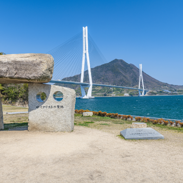
The first two kilometers along the Blue Line route from the Hakata-Oshima Bridge take you along a picturesque stretch of coastline with great views of Noshima, the former site of an island stronghold of the Noshima branch of the seafaring samurai clan, the Murakami Suigun.
From Miyakubo Port the route cuts inland and passes through the middle of the island. The two long climbs that lie between here and the entrance to the Kurushima Kaikyo Bridge make this the toughest section of the ride and carrying fluids and perhaps some energy-rich snacks is highly recommended, especially in the warmer months.
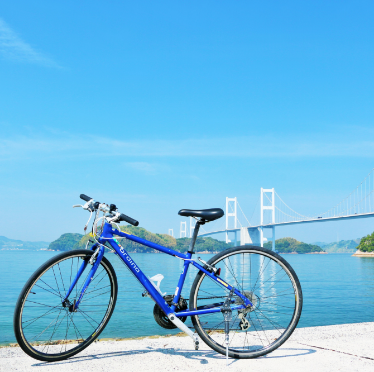
Yoshiumi Iki Iki Kan, at the southern end of Oshima, below the Kurushima Straits Bridge, has a cycle terminal, restrooms, souvenir shop, and seafood BBQ restaurant. If riding from Imabari to Onomichi, this is a good place to stock up on drinks and snacks before taking on the climbs on the way to Miyakubo.
Oshima Along the Blue Line
Just a kilometer or so along the coast beyond Miyakubo Port (from where the Blue Line route heads inland) is the Murakami Kaizoku Museum where you can learn all about the Murakami Suigun “pirate” clan that once controlled local waters. Reconstructions of the boats they used are on display outside. Inside, there are exhibits with limited English explanations inside and you can dress up in samurai armor.
Thrilling scenic cruises around Noshima which take you right into the thick of the currents that swirl around the island leave from below the museum.
Oshima boasts two incredible scenic viewpoints just off the Blue Line.
One overlooks Miyakubo Port from above a huge quarry from which Oshima Stone (known for its bluish hue and which was used in the building of the National Diet building in Tokyo) is excavated. At 380 m above sea level it is the highest point on Oshima, but the road is rather rough and you may have to share it with quarry trucks.
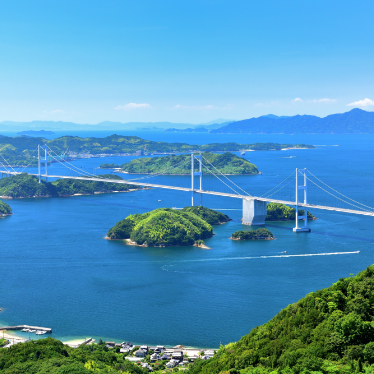
The other is on the summit Mt. Kiro in the south of the island. The observation deck, designed by world-renowned architect Kuma Kengo, offers a stunning view of the Kurushima Straits Bridge, that graces many a promotional pamphlet to the area. At 307.8m above sea level, however, cyclists have to work hard to enjoy the view.
Completists who aim to do a full loop of Oshima by continuing past the Suigun Museum along the south-eastern coast road which eventually delivers you at Yoshiumi Iki Iki Kan, be warned, that the narrow road is a real roller coaster and only recommended for the committed cyclist.
In contrast, the west coast of Oshima is generally flat with long sand beaches, little fishing ports and big shipyards, plus sweeping views across the water to the Kurushima Kaikyo Bridge.